In my last post I wrote that I intended to hit the Columbia River gorge to record some waterfalls. However, upon learning that
Silver Falls State Park south of Portland was chuck full of waterfalls, I decided to save the gorge for another day (the gorge can get really cold on a windy winter day). This is one of the most rewarding and varied hikes I've ever taken in my life. The waterfalls are breathtaking, and the trail even ventures underneath a few of them as you will see in photos below.
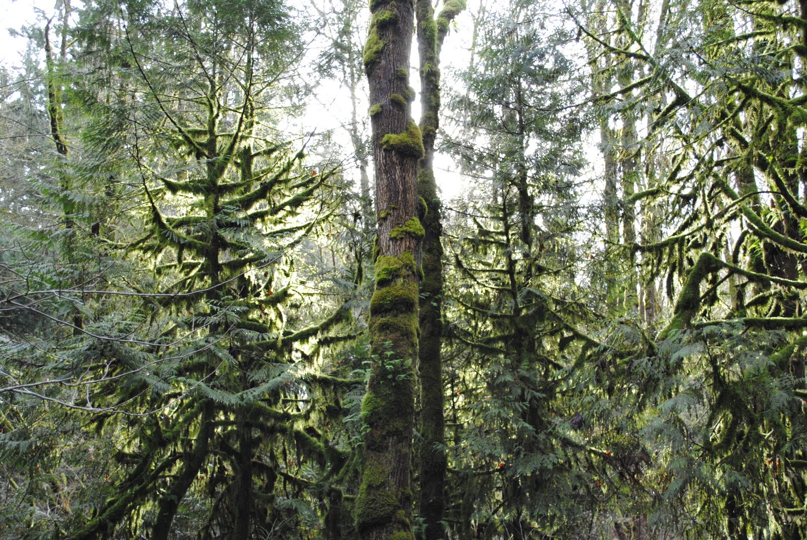
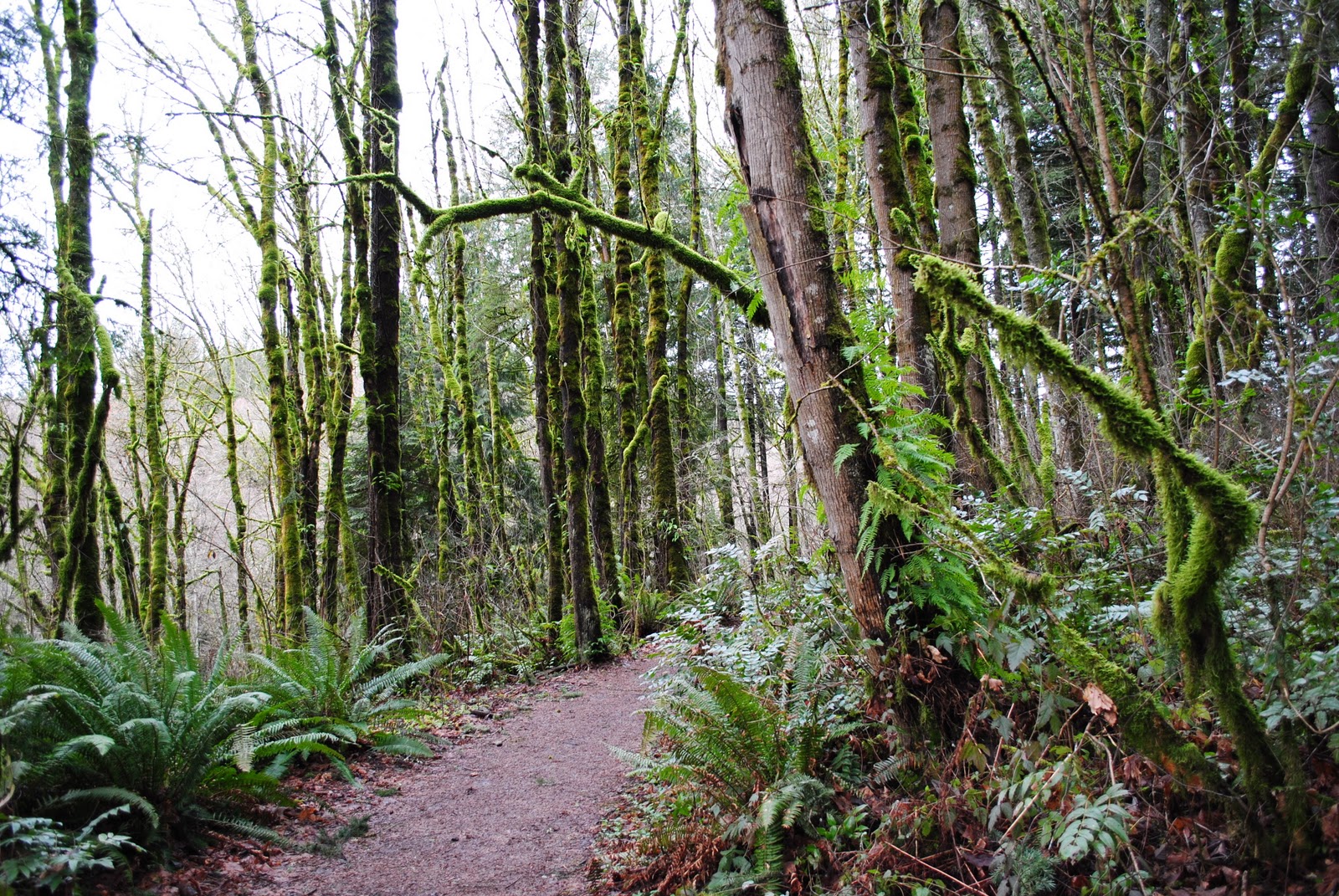
For about half the trail you follow a creek through a beautiful mossy forest and hit waterfall after waterfall. For the other half of the trail you gently walk through a massive old-growth forest right alongside OR 214. This is a state park: there are big crowds (even in wet, muddy, early January I was surprised at how many people were out hiking this trail with me), lots of parking, picnic tables, a daily usage fee, a lodge with a cafe, a gift shop, even a swimming area. The trail is wide and easy going, you are never forced to climb over a fell tree or brave any river crossings. It is a family hike, in many regards, and many families I indeed came across.
But the scenery is beautiful!
The photo below is of the infamous South Falls, which is only about a 2 minute walk from the parking lot. It is massive and roaring loud! In the photo below, you can see people walking the trail that leads behind the falls (below also you'll see a photo taken from within a "cave" behind the falls). You'll notice how dwarfed the people are next to South Falls. The falls itself is very accessible by all, even those in a wheelchair.
 |
| Silver Falls State Park - South Falls |
At 177 feet tall, South Falls is impressive. However, when you take into consideration the height of
Multnomah Falls in the Columbia River Gorge at 620 feet, which will of course be covered very soon in this blog, you realize that Oregon only gets better and better. Hard to believe while standing in front of this waterfalls though. It is beautiful. And in the summer time, I would've stopped behind the falls for several minutes getting drenched in the spray and mist before continuing on to the other falls on the trail. Not so much in January with an electronic device in my hand...
Before the hike begins from South Falls, here is a look at the park as a whole, thanks to William Sullivan and Oregon.com:
 |
| Picture by William Sullivan at Oregon.com: http://www.oregon.com/Hike_Silver_Falls_State_Park |
 |
| Silver Falls State Park - South Falls |
 |
| Silver Falls State Park - South Falls |
 |
| Silver Falls State Park - Oregon |
 |
| Silver Falls State Park - South Falls |
Just about everything within eyesight of the falls is wet, and the sound of the falls is thunderous. This was my first time being able to walk behind a waterfall. It's freaking cool, trust me. And whereas South Falls has a guard rail to make the more timorous visitors feel safer, the Middle North Falls (covered below) has no such thing.
Unless you get here first thing in the morning or in the dead of winter, chances are extremely high that you will be sharing the myriad views of the falls with lots and lots of people jockeying for family photos, clogging the trail behind the falls, and, well, sort of lessening the experience of nature at her finest. I for one recommend seeing any chunk of Nature in as less a crowd as possible. Once you get a crowd of people something natural gets taken away from Nature and something almost synthetic takes its place. The roar of South Falls just wouldn't be the same alongside the conspicuous chatter of a group of high school kids or a father shouting instructions to his family on how to pose for next year's Christmas card photo. Too many times as a kid hiking with my family in Glacier National Park was a beautiful vista or the spotting of wildlife tainted due to crowds of people jockeying for position to get the perfect angle on the same view, as well as the expectation that you'll hurry up to get your fill of the view as quickly as possible so that others can enjoy it as well. It makes Nature feel unnatural, more like the line at a theme park than a waterfall in a woodland. I digress.
With that being said, if you, like me, want to soak things like South Falls in uninterrupted an with little interference, try to see it either first thing in the morning or in the dead of winter.
 |
| Silver Falls State Park - South Falls from behind the falls |
 |
| Silver Falls State Park - South Falls |
 |
| Silver Falls State Park - Oregon |
 |
| Silver Falls State Park - South Fork of Silver Creek |
 |
| Silver Falls State Park - Oregon |
 |
| Silver Falls State Park - a tree stump converted into a seat along the trail |
 |
| Silver Falls State Park - Oregon |
Upon leaving South Falls you walk downstream alongside the South Fork of Silver Creek for quite a while. The forest in these parts is not very dense, so on a sunny day you'd likely get a considerable dose of sunlight at this point. The dense forest does not come until the walk back to your car, on the Rim Trail, which you'll see below. The walk along the creek is easy, with the chatter of a babbling creek throughout. Then, after walking down several sets of stairs, you reach the second waterfall, Lower South Falls, and the babbling creek turns into yet another roaring falls that you get to hike behind.
 |
| Silver Falls State Park - South Fork of Silver Creek |
 |
| Silver Falls State Park - Oregon |
 |
| Silver Falls State Park - Oregon |
 |
| Silver Falls State Park - Oregon |
 |
| Silver Falls State Park - Oregon |
 |
| Silver Falls State Park - Oregon |
 |
| Silver Falls State Park - Lower South Falls |
The Lower South Falls, though about half as tall as South Falls (93 feet compared to 177), seems about twice as wide. The hike you take to go behind the falls, seen in a photo below, is very narrow. This will make you both very excited and very wet, unless you run through it like you're shooting the gauntlet. This falls too, especially due to its width, feels massive!
 |
| Silver Falls State Park - Lower South Falls |
 |
| Silver Falls State Park - Lower South Falls |
 |
| Silver Falls State Park - Lower South Falls |
 |
| Silver Falls State Park - Lower South Falls |
 |
| Silver Falls State Park - Lower South Falls behind the falls |
 |
| Silver Falls State Park - Lower South Falls |
 |
| Silver Falls State Park - North Fork of Silver Creek |
 |
| Silver Falls State Park - North Fork of Silver Creek |
 |
| Silver Falls State Park - Canyon Trail and Ridge Trail junction |
 |
| Silver Falls State Park - Oregon |
 |
| Silver Falls State Park - Canyon Trail |
 |
| Silver Falls State Park - Canyon Trail |
 |
| Silver Falls State Park - Canyon Trail |
 |
| Silver Falls State Park - North Fork of Silver Creek |
 |
| Silver Falls State Park - Canyon Trail & North Fork of Silver Creek |
 |
| Silver Falls State Park - Canyon Trail |
 |
| Silver Falls State Park - Canyon Trail |
 |
| Silver Falls State Park - Canyon Trail bridge over the north fork |
 |
| Silver Falls State Park - Lower North Falls |
 |
| Silver Falls State Park - Double Falls |
 |
| Silver Falls State Park - Canyon Trail |
|
|
 |
| Silver Falls State Park - Drake Falls, the least eventful falls of the hike |
Above, you will see three of the "least significant" falls of the hike, and by "least significant" I do not mean insignificant. Lower North Falls is a lot larger than it looks in the photo above. Those are massive tree trunks that have lodged themselves into the bottom of the falls. I wish it were possible to get closer to this falls, but alas it is not, probably for safety reasons. There are many little signs upstream from the falls warning hikers not to wade in the creek in this area, for fear of them being swept away and thrown over the edge of the falls. Trust me, even though Lower North Falls looks like a glorified natural water slide (at least this is what I thought while looking at it) I would not suggest taking that plunge.
Double Falls is tucked a short ways back from the main trail. In the summer, I assume it becomes a bit of a natural shower for sweaty hikers. One could very easily walk right up to the falls and stick your hand into it. This would be one of the best places throughout the state park to take your shoes off and wade for a while.
If you were to pick up Drake Falls and drop in on any trail in Oregon that does not contain a waterfall, it would probably be the highlight of the trail. However, amid all of its bigger brother waterfalls here in Silver Falls State Park, little Drake Falls deserves about a quick glance over the ledge of this man-made lookout deck and that's about it. There are bigger and better falls to stand and stare at, like Middle North Falls just a short walk past little old Drake.
 |
| Silver Falls State Park - Middle North Falls |
 |
| Silver Falls State Park - Middle North Falls |
 |
| Silver Falls State Park - Middle North Falls |
 |
| Silver Falls State Park - Middle North Falls trail behind the falls closed due to hazardous conditions |
I am guessing that due to the wet ground, the amount of water coming off the falls thanks to heavy rains lately, and the lack of any guard rail led to the park rangers closing off the trail that led behind Middle North Falls, which is a wonderfully violent waterfall. Needless to say, this did not stop me from passing beyond the barricade, nor did it stop one of my fellow hikers/photographers captured in the distance on the right side of the photo above. Regarding the photo below, try to walk as close to the inside of this hike as possible. If you were to lose your footing, you would slide down very slippery earth into a large rocky coffee cup with little hope of getting out of it alive, especially given the weight and temperature of the water that will be pounding you into the bottom of said large rocky coffee cup. So, that being said, there IS a good reason why this trail is blocked off from time to time; and, if you like me venture past the barricade, by all means don't push your luck. There is a huge difference in being adventurous and being precarious.
 |
| Silver Falls State Park - Middle North Falls trail behind the falls |
 |
| Silver Falls State Park - Middle North Falls |
 |
| Silver Falls State Park - bridge to Winter Falls |
 |
| Silver Falls State Park - en route to Winter Falls |
 |
| Silver Falls State Park |
 |
| Silver Falls State Park - Winter Falls |
Shortly after Middle North Falls you come to a bridge where you can either continue straight to North Falls or turn right, across the bridge to Winter Falls, and then back to your car parked near South Falls. This gives you about a 5 mile hike for the day. If you continue to North Falls, you're looking at more like 7 total miles for the day.
Having had little breakfast because of my impatience to hurry up and get to Silver Falls S.P., I was starting to feel damn hungery upon reaching the bridge, making the option of taking the short cut back to my car all the more appealing when I knew that a burger and an ice cold beer would be in my stomach that much sooner. My empty stomach overruled my desire to hike to North Falls, but I knew that I would be back to Silver Falls S.P., if not in the very near future. So I made a break for the short cut.
Winter Falls, like South Falls, is a very short walk away from a parking area / trail head right off of OR 214. You can get a great view of the falls, and there is a bench were you can take a break before your trek back to your car via Rim Trail, which is gorgeous.
 |
| Silver Falls State Park - Winter Falls bench |
 |
| Silver Falls State Park - Winter Falls area |
Upon coming up from Winter Falls into the parking area and trail head, you come out upon OR 214 and follow it all the way back to the South Falls parking area. The walk back, or, Rim Trail, is stunningly beautiful, even if OR 214 is never far away and the sound of the occasional car lends a contrasting element to the old-growth forest you're walking through. There is even a bike-path that parallels the foot-trail for much of the way. There was something about the way the sunlight was hitting the forest that made it feel surreal. Some of the trees you come across are massive and almost overwhelmingly majestic, especially this one gigantic two-headed monster of a tree.
 |
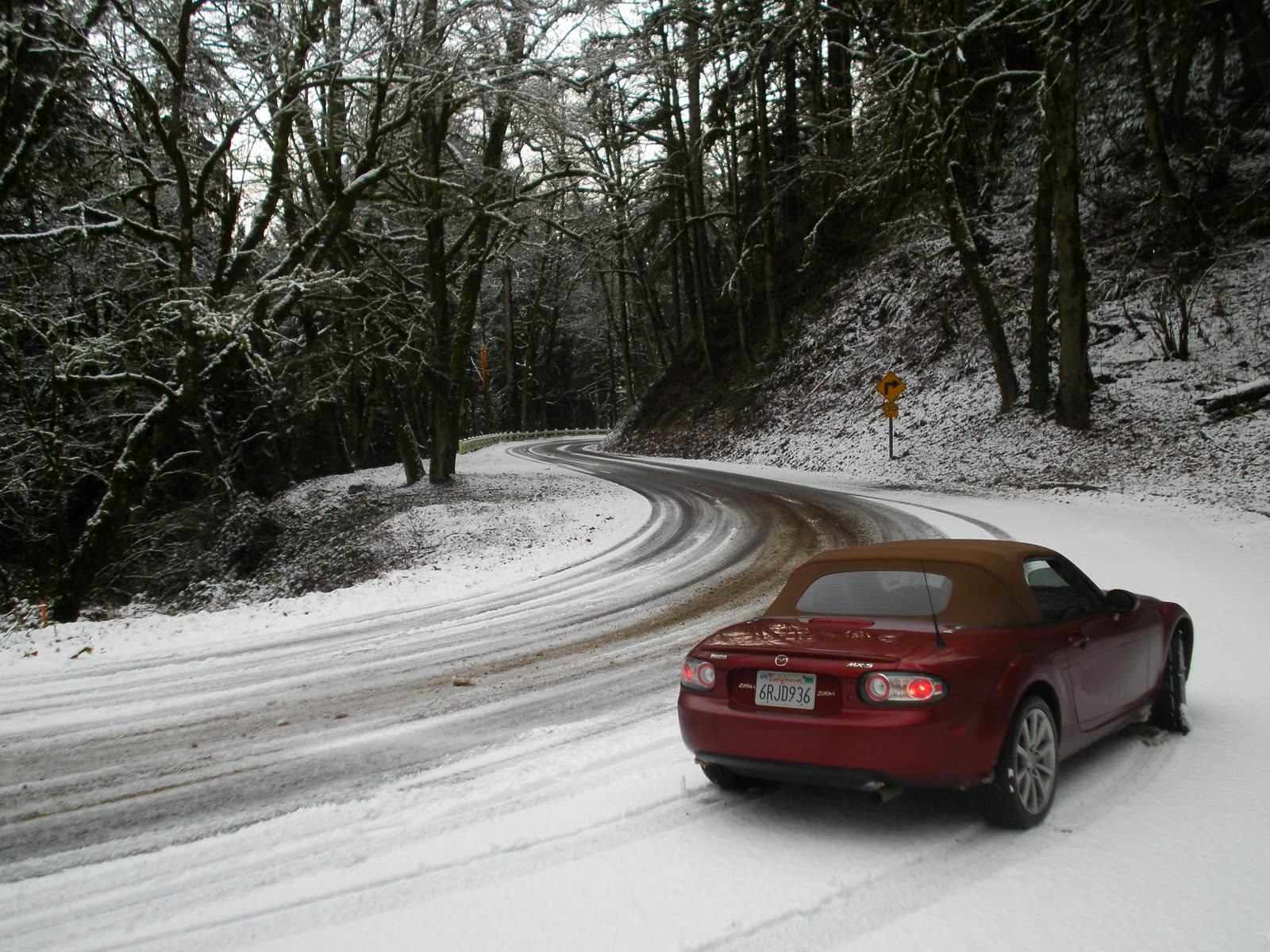
| OR 214 in the Silver Falls area |
 |
| Silver Falls State Park - Rim Trail |
 |
| Silver Falls State Park - Rim Trail |
 |
| Silver Falls State Park - Rim Trail |
 |
| Silver Falls State Park - Rim Trail |
 |
| Silver Falls State Park - Rim Trail |
 |
| Silver Falls State Park - Rim Trail - by backpack next to a massive tree for comparison |
 |
| Silver Falls State Park - Rim Trail |
Near the South Falls parking area you'll find a lodge and a gift shop. The lodge is quaint and comfortable on the inside, with a fire lit in the fireplace and a cafeteria that sells hot food and beverage (albeit, for a higher price than necessary). Sorry though, folks, no Oregon microbrews are sold here. In a perfect world, in a perfect world...
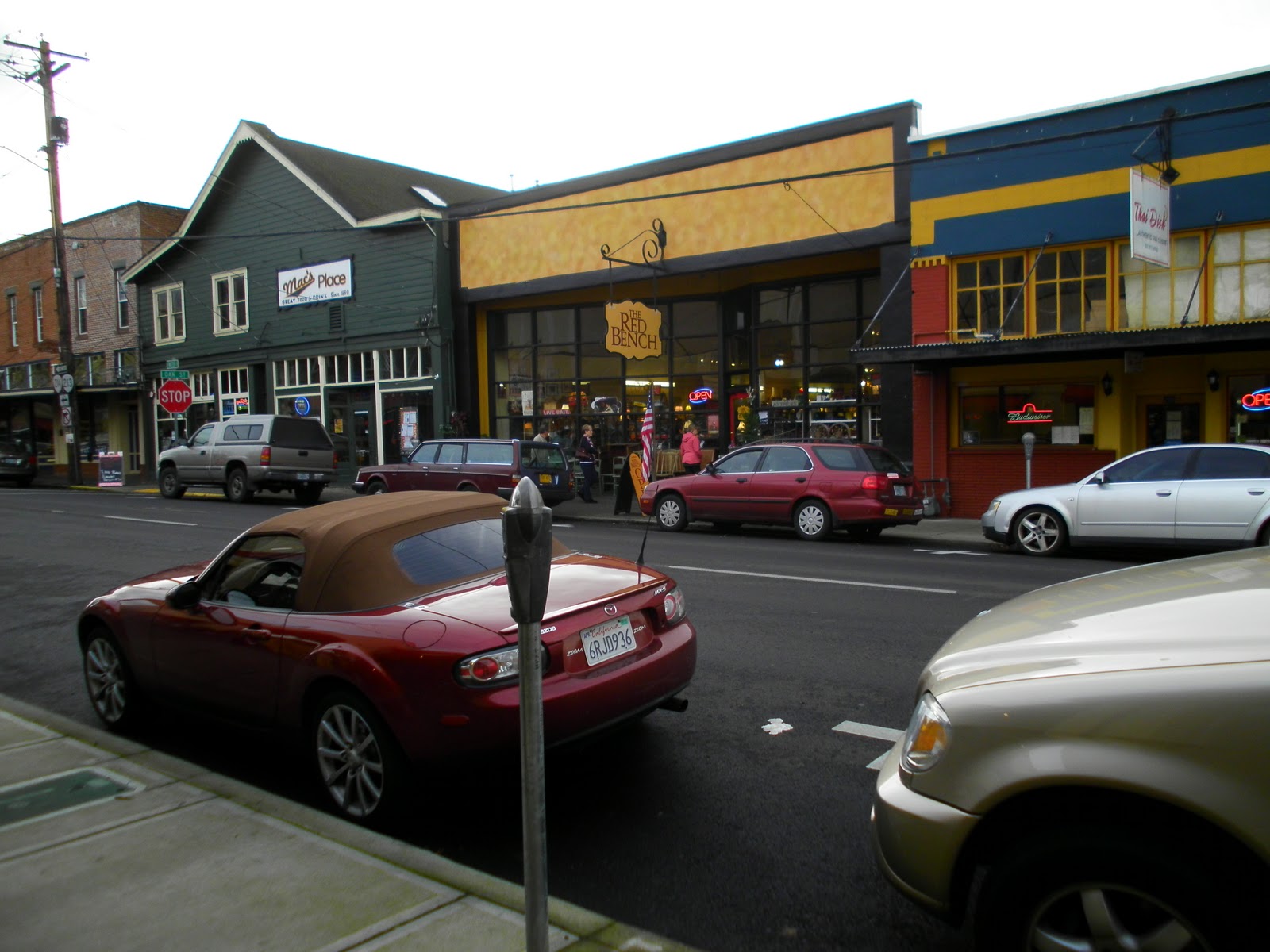
So as I was checking out the lodge I noticed a little old man wearing what appeared to be half Ranger uniform, half American Legion vest sitting behind a make-shift brochure table. I approached him and asked him if he was from around here. "Lived in Silverton all my life," he said in a stern and raspy old man voice. I asked: "Where could I get a good burger and a beer in town?" He perked up upon my mentioning the word beer. "Oh! Mac's Place downtown, across from the old theater. An old bar really, but my they have some good food!" Thanks, my friend. Mac's Place it is!
 |
| Silver Falls State Park |
 |
| Silver Falls State Park - Lodge |
|
 |
| Silver Falls State Park - Lodge |
Downtown
Silverton, Oregon is home to one of the greatest burger joints in the United States. If I see that old man who recommended I eat a burger at
Mac's Place, I'm going to shake his hand and tell him thanks. I just ordered a straight-up cheeseburger with swiss and it was easily the best cheeseburger I've had west of the Mississippi. It was around $7 but honestly even better than the $12-14 gourmet burgers I've had at Father's Office and Umami Burger in Los Angeles. I had a pint of
Fearless Scottish Ale, which unbeknownst to me is made right down the road in Estacada, Oregon. It reminded me of the beers I tasted over in Scotland and England- smooth, malty, slightly bitter, and absolutely delicious. It may be my new favorite beer made in Oregon (which I hesitate to proclaim given Oregon's unreal craft beer scene).
If you hike Silver Falls State Park and you find yourself hungry at the end of it all, you simply have to finish the day at Mac's Place. Just as I fell in love with the food and drink at the Zigzag Inn after my hike at Salmon River, so I did the same with Mac's Place today. A tradition has been born today. Ever time I hike Silver Falls I will be ending my day right here, with a burger and a beer.
 |
| Downtown Silverton, Oregon - Mac's Place |
 |
| a pint of Fearless Scottish Ale at Mac's Place - Silverton, Oregon |
 |
| quite possibly the best cheeseburger I've ever had & a Fearless Scottish Ale - Mac's Place - Silverton, Oregon |
In the very near future, I will update this blog with photos of North Falls and the trail that leads to and from it from Winter Falls.
In other very good news, for those of you out there who really know your cameras, you may have noticed that the photos I've been taking up until this point have not been taken with the greatest quality of equipment. This is because up until now I have been using a point-and-click digital camera. You know, the kind of camera middle school kids take on field trips? The kind college students take with them to the bars on Thursday nights? Yeah, that kind. Well I'm proud to say that my investment into this blog is no long just an investment of time, energy, and TLC. I have purchased a new Nikon D3000 and a tripod, both of which will be accompanying me on my hikes henceforth. Expect vastly better, clearer, more colorful photos to come. Likewise, expect this blog entry and the ones that came before it to be re-done one day with the addition of the higher quality camera. I will likely name such a post "Silver Falls State Park Revisited."
Also, for a change of scenery, expect an Urban-Hike entry in the near future, where I will walk one of Portland's iconic and varied neighborhoods and try best to capture its unique feel in photo.
Silver Falls State Park, south of Portland, east of Salem, in the foothills of the Cascades.