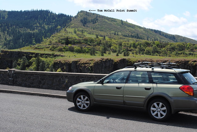
Tom McCall Point Summit at Tom McCall Preserve
3.4 miles roundtrip | 1,100 feet elevation gain
 |
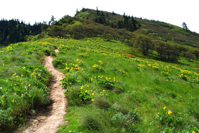
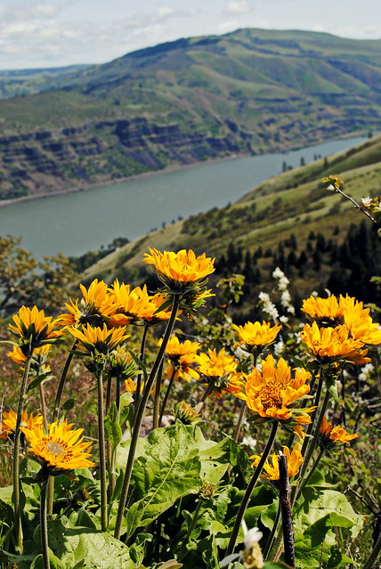
| Balsamroot along the Tom McCall Point trail - Eastern Columbia River Gorge |
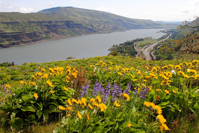
East of Hood River, Oregon, right outside of a little town called Mosier via the twisty and gorgeous Historic Columbia River Hwy, lies the Tom McCall Preserve- a windy, wildflower paradise atop a plateau with excellent views of the river down below.
A circular parking area just off the Historic Columbia River Hwy (henceforth abbreviated as the HCRH) is a beautiful place for motorists to show off their cars as well as the starting point for two hikes: an easy one that brings you down to the edge of the plateau past a couple of ponds and a moderate-to-difficult one that climbs to a summit with a panoramic view to the west. It was the latter which I did today.
 The first observation I made when exiting off of interstate 84 and onto this eastern stretch of the Historic Columbia River Hwy was "man it is so pretty out here!" The dry Eastern Gorge looks and feels (and smells) very different than the wet Western Gorge, and I highly recommend Portlanders and others living west of the Cascades to jump over to the eastern side once in a while. It is such a beautiful change of scenery. The Eastern Gorge reminds me to an extent of certain parts of California, Idaho, and Colorado. Ponderosa Pines rather than Douglas Firs. Grassland rather than ferns. Wildflowers rather than moss. Dirt rather than mud. Sun rather than clouds. It is almost as if by driving through the town of Hood River you exit one ecosystem and enter an entirely different one (making the town of Hood River even more appealing than it already most certainly is).
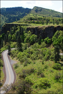
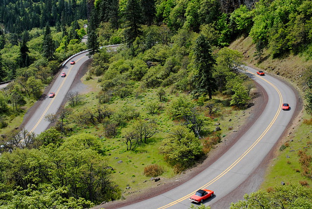
The HCRH winds through the sleepy but charming town of Mosier and up into beautiful meadows. This short stretch of the HCRH between Mosier and Rowena is one of my favorite roads to drive. It is bucolic, breezy, manicured, twisty, a motorist's wet-dream. Growing up in the Midwest, with its dull, straight roads lined with flat, boring farmland, I only dreamed of one day living in a state with roads this exciting and scenic.
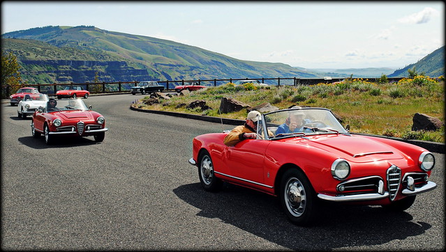
As I arrived at the circle drive/parking area at Tom McCall an Alfa-Romeo automobile club was just about to embark on their weekend drive. And I must say, what a perfect rendezvous point for a classic automobile club! I was able to park and take a few photos as the old, Italian beauties were melodiously buzzing out of the parking lot and down the HCRH's hairpin curves.
Here are some photos:

 |
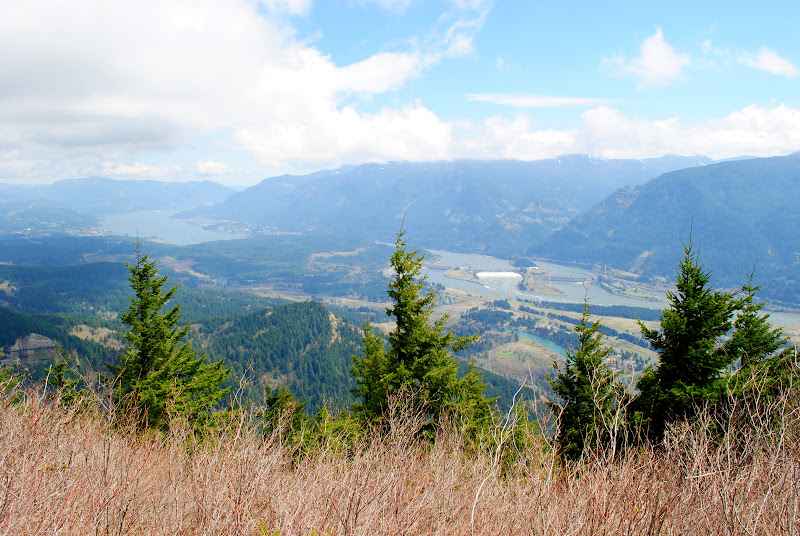
| The twisty Historic Columbia River Hwy with Interstate 84 paralleling the river and heading east in the distance |
Distracted by the Alpha Romeo's, each with their own snarl-y exhaust rips, it wasn't until after the car club left that I realized how dang WINDY it was out here! I didn't even bother wearing a hat, because it would've instantly blown off; and what would have otherwise been a hot day actually turned out to be borderline cold given the blasts of chilled air blowing in from the east. I began regretting that I only had a light long-sleeve shirt. But, thankfully, the upcoming hike was steep, so I immediately warmed up, even to the point of shedding the long-sleeve.
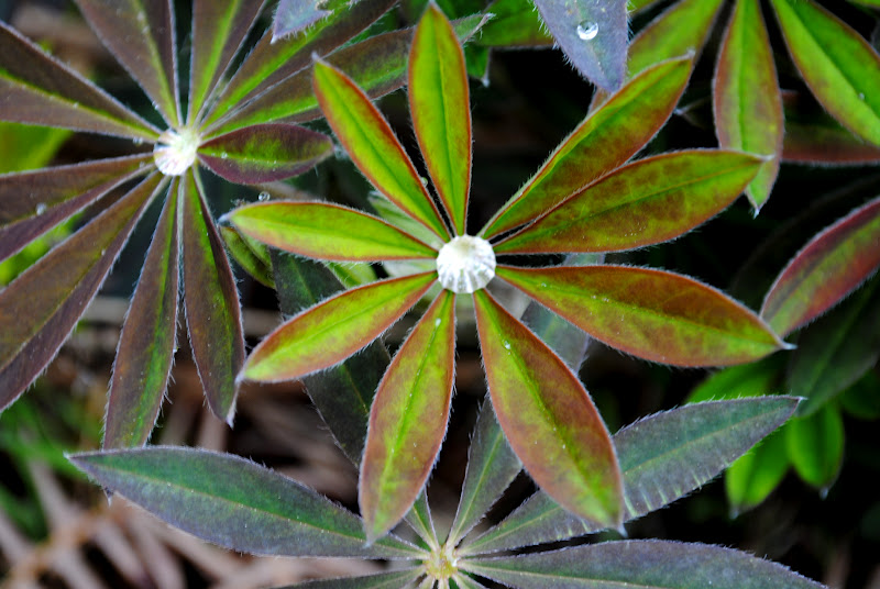
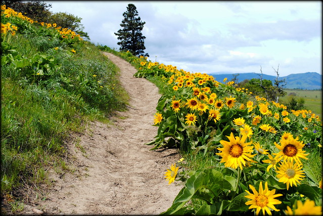
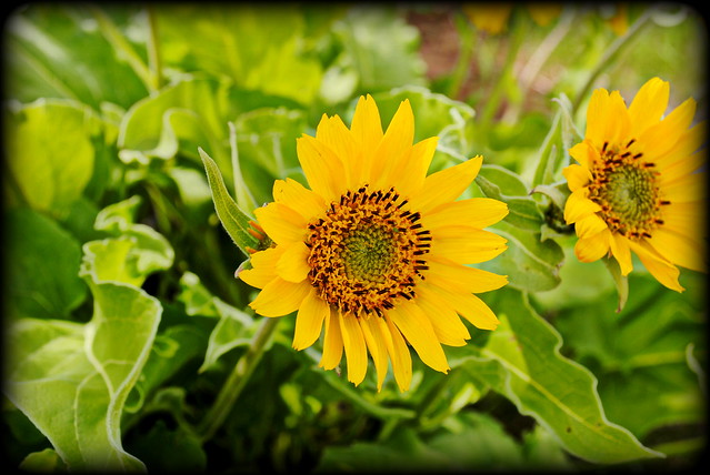
All those little yellow dots you see out there in the grasslands when you drive into Tom McCall, yeah those aren't dandelions. They're yellow balsamroot... and they are everywhere! And those little accents of purple you see amid the clusters of yellow are blue lupine! May is the quintessential time to visit Tom McCall for this very reason: Wildflowers!
Here are some photos of what to expect flowerwise:
 |
| Balsamroot |
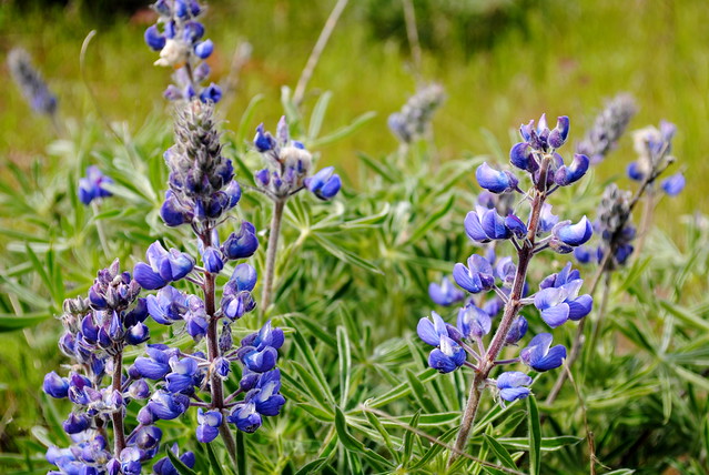 |
| Blue Lupine |
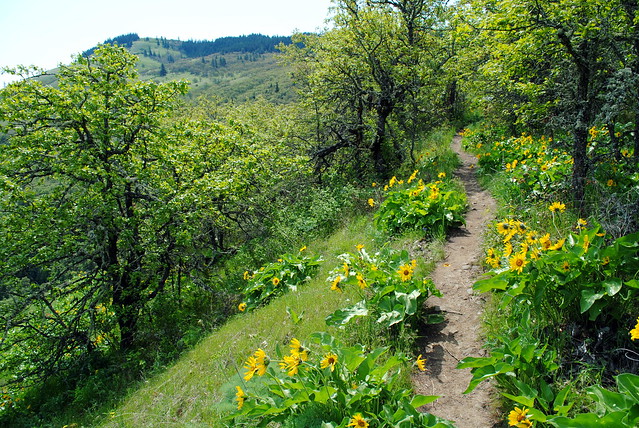
The hike leading up to the summit of Tom McCall Point is not the steepest hike I've ever taken, but it is pretty damn steep. You'll get a work-out, let's just say that. It's only 1.7 miles to the top, but you climb the entire time. By the time you finally get to the top you'll be eager to sit down for a moment. If this steep hike were much more than 1.7 miles one way I would likely classify this as a difficult hike rather than a moderate hike. The main reason I find it more moderate than difficult is because the brutal climb is over fairly quickly. So consider this a nice, quick work-out.
Here's a rough look at where you are going when you hike to the Tom McCall Point Summit:
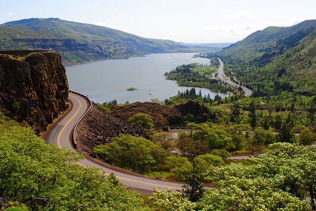
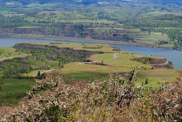
If it wasn't for the continual, strong winds I would've broken quite a sweat, especially given the sun, on this climb. Once you get to the summit I suggest sitting down and relaxing for a while. Take in the views and the wildflowers. On a clear day you'll see Mt. Hood's head in the distance behind the hills. On the way back down you'll have a bird's-eye-view of the little river town of Lyle, Washington, as well as interstate 84 and the twisty HCRH down below. Just keep an eye out for poison oak (see below).
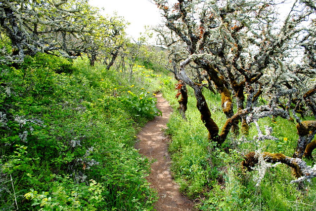
Here are photos of the hike up to Tom McCall Point :
 |
| from the Tom McCall Point trail - Tom McCall Preserve - Eastern Columbia Gorge |
 |
| Looking up at the summit of Tom McCall Point - Tom McCall Preserve - Eastern Columbia Gorge |
 |
| Tom McCall Preserve - Eastern Columbia Gorge |
 |
| Looking down at the parking area and plateau - Tom McCall Preserve - Eastern Columbia Gorge |
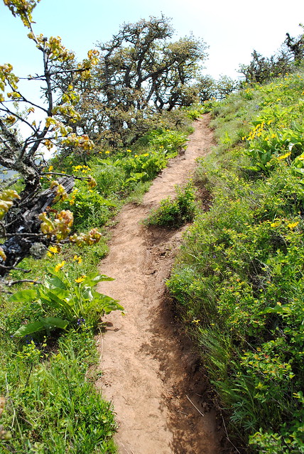 |
| The trail can get STEEP! - Tom McCall Preserve - Eastern Columbia Gorge |
 |
| Tom McCall Preserve - Eastern Columbia Gorge |
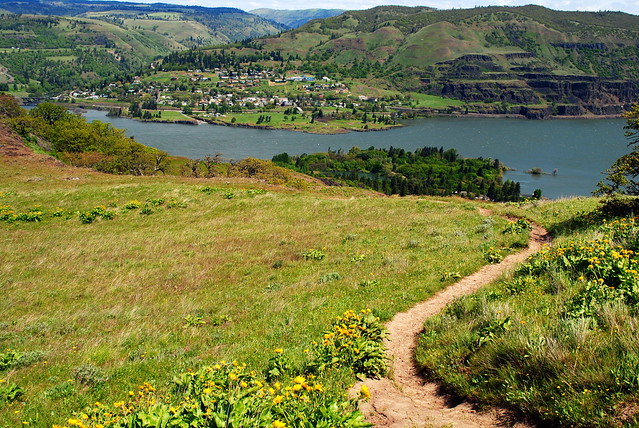 |
| Lyle, Washington from the Tom McCall Preserve - Eastern Columbia Gorge |
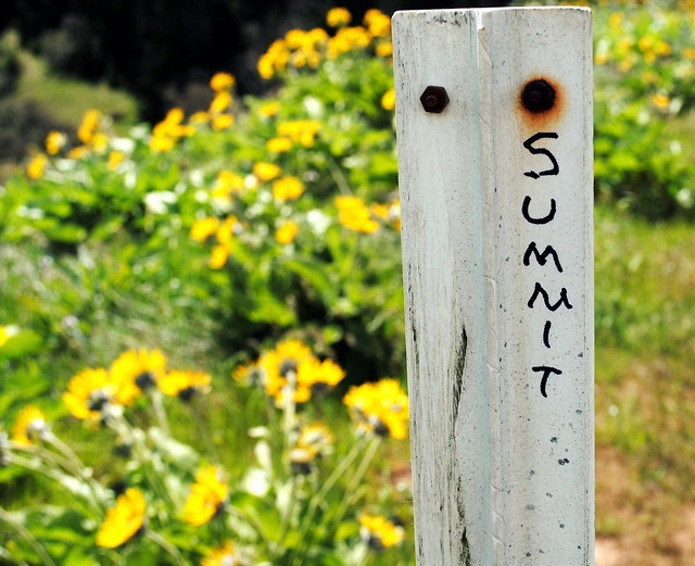 |
| The make-shift summit marker at the Tom McCall Preserve - Eastern Columbia Gorge |
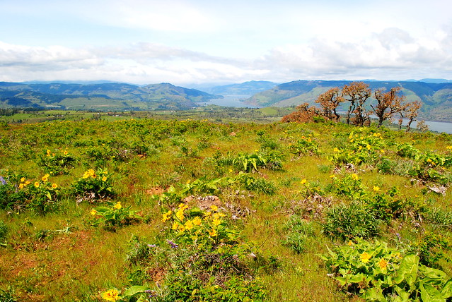 |
| View looking west from the summit at Tom McCall Preserve - Eastern Columbia Gorge |
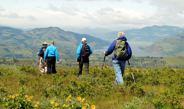 |
| Hikers on the summit at Tom McCall Preserve - Eastern Columbia Gorge |
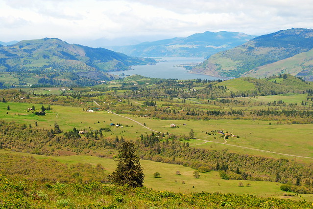 |
| View looking west from the summit at Tom McCall Preserve - Eastern Columbia Gorge |
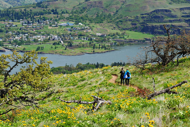 |
| Hikers on their way back down with Lyle, Washington in the distance - Tom McCall Preserve - Eastern Columbia Gorge |
But.... one a quick side note...
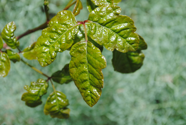
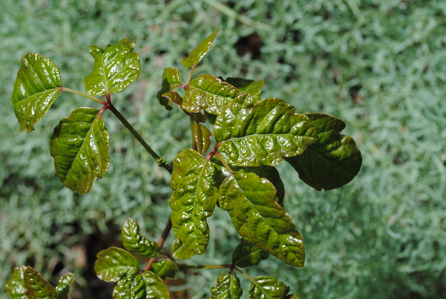
WARNING: POISON OAK!!!!
The hike up to the Tom McCall Point summit is full of some of the oiliest, nastiest poison oak I've ever seen, much of which lines the trail itself. If you don't know what it looks like, see below. It's a three-leafed plant: one leaf straight forward from the stem and the other two on each side. It is usually rather droopy as a plant too, and it is almost always close to the ground. I would highly advise you not to wear shorts on this trail, regardless of how hot it is. If you so do wear shorts make sure to wear high socks and pull them up. But even then, you had better watch where you're going. I have never personally experienced poison oak, but I've heard that once you get it, you will do whatever it takes to never have to endure it ever again.
One word of advice: this trail can get crowded, especially on spring and summer weekends, but the trail is also very narrow and populated with poison oak. Chances are you will have to step aside into vegetation to let hikers pass by, and when you do, watch where you step! When I was coming back down the trail a couple of hikers stepped aside to let me pass, and as I walked by I noticed they had stepped right into a bunch of poison oak. Luckily they had long pants on, but the oils on poison oak can travel on clothing and shoes, only to rain on your parade at a later time. So watch where you step, especially if you have to step aside to let fellow hikers pass.
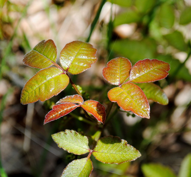
Here is what Poison Oak looks like. And note, it isn't always green. Sometimes, especially in the fall, it can take on a red color. And also note that is it not always this shiny either. This is some of the oiliest, nastiest poison oak I've ever seen. My wife, who's suffered through a bout with poison oak before, could hardly even look at these photos. So, apparently it is not a pleasurable experience.
But let's shy away from that scoundrel poison oak and end this blog entry on a more jubilant, positive note, what do you say? Let's move away from poison plants and on to a delicious ones instead, namely locally-grown hops and cherries.
After hiking Tom McCall Point I was looking for any means by which to get out of the roaring wind and rest my legs. And what better place to do this than at Double Mountain Brewery & Taproom in downtown Hood River, Oregon? That's a rhetorical question...
Double Mountain makes some of the greatest beers I have ever tasted; and needless to say I have been eager to sample every damn beer they've ever crafted. I have also heard really good things about their pizza, but sadly I couldn't try it this time around- their kitchen was closed due to renovations and expansion (but hey, this is great news- Double Mountain is expanding!!). But no worries, I will return to Double Mountain over and over again in my numerous trips to Hood River. I will, in due time, gobble down a slice or two of their pizza, and wash each down with a beer of theirs I haven't tried yet.
I tried two today: the Gravity Mountain Collaboration IPA (a joint venture between two of Oregon's most beloved brewers- Double Mountain and Terminal Gravity) and the Devil's Kriek Fruitbeer (a tart Belgian lambic fermented with 200 pounds of locally-grown cherries). Both were absolutely outstanding! The Kriek's full-bodied cherry flavor reminded me of the cherry wines made in southwestern Michigan where my family and I used to vacation. Being a lover of IPA, I was especially fond of the flavor, mellow mouthfeel, and quality of the Collaboration. One of the most refreshing yet complex IPAs I've ever tasted.
Here are a few photos from Double Mountain Brewery & Taproom in downtown Hood River, Oregon. No, it isn't typically dusty, it's under construction:
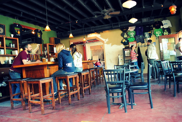 |
| Double Mountain Brewery & Taproom - Hood River, Oregon |
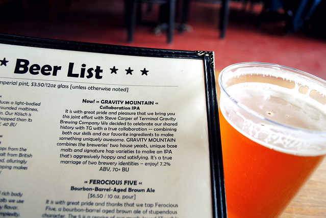 |
| Gravity Mountain Collaboration IPA (Terminal Gravity & Double Mountain Breweries) - Hood River, Oregon |
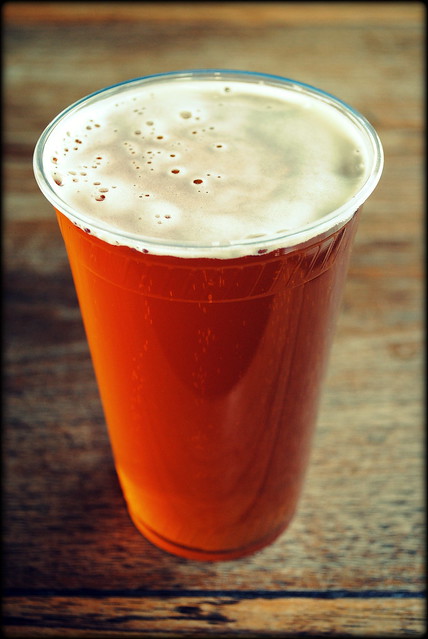 |
| Gravity Mountain Collaboration IPA - Double Mountain Brewery & Taproom - Hood River, Oregon |
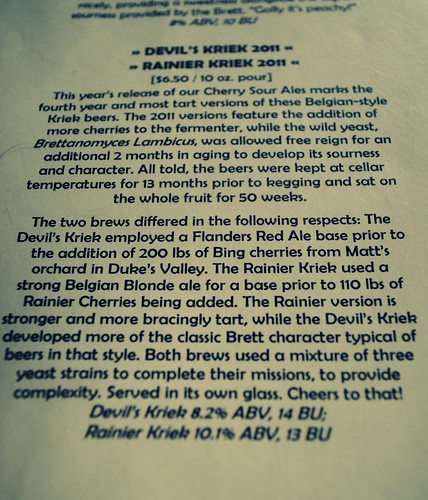 |
| Two cherry brews on tap at Double Mountain Brewery & Taproom - Hood River, Oregon |
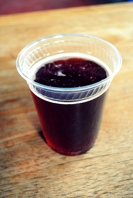 |
| Devil's Kriek - Double Mountain Brewery & Taproom - Hood River, Oregon |